
Map Orange Township Neighbors
One Orange Township address can reveal the immediate parcel pattern around it. The strongest sources are the county GIS buffer, the selected property card, recorded instruments, and subdivision or survey plats. Each answers a different question. GIS shows physical proximity and parcel geometry. The property card records an owner and property facts. A Recorder result can date a title connection. A plat can explain lots and blocks. None of those sources supplies a verified list of everyone who lives nearby.
| Source | What it shows about a block | Access path |
|---|---|---|
| Auditor GIS buffer | Selected parcel and nearby parcel polygons or list. | Public map tools with TXT, CSV, or PDF export. |
| Auditor property card | Recorded owner, situs address, value, and conveyance data for each parcel. | Public property search; record the source date. |
| Recorder tract index | Instrument and title links tied to owner and legal description. | Web index for stated modern coverage, then office research. |
| Subdivision or survey plat | Lot, block, survey, and physical-adjacency context. | GIS layer and popup PDF where available. |
| Board of Elections tool | Official information for one named individual only. | Individual lookup or direct Board contact. |
| Township zoning file | Development, work, or land-use context at one location. | Application channel or focused records request. |
Orange Township neighbors should therefore be described as nearby parcels and recorded owners unless an independent, lawful source says more. On an Orange Township block, an owner mailing address is only the address used for correspondence. It does not prove that the owner, or anyone else, occupies the nearby parcel.
Trace Orange Township Neighbor Parcels
Delaware County GIS provides a repeatable adjacent-parcel method that works better than guessing from house numbers. Curved roads, cul-de-sacs, uneven lots, and municipal boundaries can make the next street number a poor proxy for an adjoining property. Start with the known parcel, keep its legal description, and treat each surrounding parcel as its own record. This process produces an ethical property comparison, not a household roster.
- Find the address, owner, or parcel number in Auditor GIS and select the correct Orange Township parcel.
- Choose Tools, then Buffer. Enter a distance and unit, select Selected Parcels as the source, and run Buffer to create a nearby-parcel list.
- Open each returned parcel or directly adjacent polygon. Preserve the parcel number, recorded owner, situs address, legal description, market or transfer data, and source date.
- Turn on Subdivisions or Survey Plats when the lot pattern needs explanation, then open a scanned source from the popup when available.
- Use the Recorder only after matching the parcel’s legal description and owner to the recorded instrument trail.
For the broader chain along a named road, use the Orange Township Street Directory. That Orange Township street workflow adds the full address-to-deed sequence without converting a block map into a list of residents.
Note: Keep the buffer distance, map date, and parcel selection with the export so another researcher can reproduce the limited property comparison.
Orange Township Neighbor Buffer Tool
The official GIS Help Guide documents the selected-parcel Buffer tool, including distance, units, selection source, and TXT, CSV, or PDF exports. Those exports are useful working notes for an Orange Township block because they show why a parcel was considered nearby. They are not a survey, and the county cautions that its parcel lines are reference mapping derived from deeds, surveys, and plats.
Use Tools to measure a line or area only when a visual comparison helps explain parcel shape. The map also supports layers for parcels, historic imagery, boundaries, floodplain, school and tax districts, dimensions with limited coverage, plats, and surveys. An Orange Township selected-parcel popup connects to the Auditor’s Site for appraisal details. The record trail remains stronger when the map result is paired with the property card, legal description, and recorded document.
Orange Township Neighbor Parcel Limits
A nearby parcel commonly supplies three separate facts: situs address, recorded owner, and owner mailing address. The situs is the land and improvement location. The recorded owner is the person or entity named in the tax or appraisal source. The mailing address is where tax correspondence is sent. An off-site owner, trust, or entity can make those entries differ. A physical occupant may not appear in the tax roll at all.
A homestead marker, if an Orange Township property record displays one, is evidence about a tax claim or qualification. It is not a census of the household. The same caution applies to conveyance dates, market values, bedrooms, and photos. They describe a parcel or transaction context. They do not identify who lives there now, nor do they prove a relationship between people associated with two nearby parcels.
Note: Record the exact field label and date for an Orange Township parcel fact rather than translating it into an unsupported claim about occupancy.
Orange Township Neighbor Voter Checks
Ohio Voter Information is not a public tool for browsing every voter in a radius. It supports an individual official lookup after a name and other corroborating facts are already available. The current statewide search uses first name, last name, and county. Delaware County also provides an individual form. An official result may offer a limited, dated confirmation point, but an absent result does not disprove an Orange Township connection.
The statewide voter database includes residence and precinct concepts, but public law excludes sensitive identifiers, confidential voter records, and protected addresses from ordinary release. Safe at Home participants have a confidential pathway, and qualifying public-safety personnel and family members can request residential-address redaction. If an Orange Township request concerns releasable voter data, ask the Delaware County Board of Elections for current access conditions, fields, fees, and redactions. Do not use public data to reconstruct a block roster.
Orange Township Neighbor Community Contacts
Orange Township’s official community links and zoning material can help identify the government and development geography around a block. The research did not locate an official township-operated member directory for neighborhood associations or HOA households. A public association contact page, if one exists, is the organization’s own publication, not a public record and not a basis for a member roster. Contact the organization through its published channel instead of collecting private membership information.
| Community layer | What it provides | Member-directory status |
|---|---|---|
| Orange Township Community Links | Official referral page for township, county, and state services. | No member directory identified. |
| Orange Township zoning map | Roads, zoning, boundaries, incorporated areas, parks, schools, and landmarks. | Use to identify development geography, not people. |
| GIS subdivision plats | Lot, block, and legal-description context for a development. | No resident or member roster. |
| DCDL and Cryder local history | Dated newspapers, directories, yearbooks, maps, and other collections. | Historical clues only after a specific source is consulted. |
| Block-watch or congregation lists | No official or institutional source was located in the research sweep. | Contact the organization directly; do not scrape member lists. |
The Orange Township community links page and the Township zoning map are the appropriate starting points for an Orange Township community-geography question. They do not identify members or residents.
Orange Township Neighbor History Sources
For a past household or a long-ago block, the best evidence changes with the era. The Delaware County District Library Local History Room holds historical directories, census microfilm and indices, cemetery inscriptions, church histories, yearbooks, and local files for in-library use. Cryder Research Library adds rural-route directories, property transfers from 1800 through 1891, obituaries, maps, atlases, and newspaper material. A listed household is a clue tied to the particular edition or record date, not a present-address conclusion.
County records make the access channels important. The Recorder’s online real-estate statement begins in 1990, with earlier records and some online exceptions handled in the Recorder’s office. The library and Cryder provide the historical layer when an Orange Township block question crosses decades. For a single home’s earlier occupants, the previous-residents workflow connects the deed chain to those dated collections without treating one printed listing as complete proof.
Orange Township Neighbor Sources Compared
Official records and commercial neighbor-search products are not interchangeable. The official trail exposes a source, date, custodian, and limited type of fact. Commercial products, as a category, can blend old mailing records, property data, and unverified household associations. That blend may be convenient, but it cannot override a protected address, establish present occupancy, or substitute for the document held by the county office.
| Record path | What it can substantiate | Boundary |
|---|---|---|
| Official GIS and property card | Parcel location, recorded owner, situs, and selected property facts. | Owner and mailing address do not prove residents. |
| Recorder instrument | Dated party, legal description, and title-chain connection. | Not a current-residence declaration. |
| Board voter tool | Limited official result for an identified individual. | No public block-browse function; protected records remain protected. |
| Commercial neighbor products | Mixed, date-variable associations. | Use no result as a substitute for a custodian record or confidentiality rule. |
A source-first Orange Township method leaves a usable audit trail: selected parcel, map date, property-card fields, Recorder reference, and any dated historical source. An Orange Township record trail also makes it easier to correct a same-name or old-mailing-address mistake before it becomes a claim about someone’s home.
Orange Township Neighbor Record Dates
Current displays can be time-sensitive and must not be converted into a neighbor fact. The Sheriff’s JailTracker interface is a current detainee roster, not a criminal-history record and not evidence of a person’s current home. A custody display can change quickly. If a public record is needed from the Sheriff, use the office’s records-request channel and expect statutory limits for active, medical, security, victim, juvenile, and personal information.
The Delaware County Sheriff JailTracker roster is shown as a time-sensitive public interface, not as a neighborhood source.
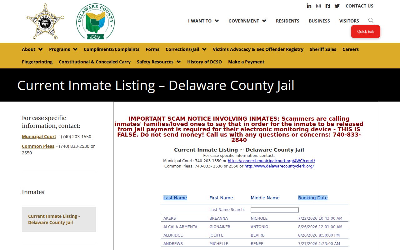
The image underscores why a dated Orange Township record check must stay tied to the source’s stated purpose rather than being repurposed to infer residence or a complete personal history.
County parcel geometry also needs a date. The Delaware County GIS transition notice said in June 2026 that replacement mapping would temporarily lack some newer Orange Township parcel changes while updates occurred. Preserve the deed, plat, or survey where a current map difference matters.
Orange Township Neighbor Vital Records
Birth and death certificates answer event questions through their proper custodians. They are not a method for identifying Orange Township neighbors. The Delaware Public Health District provides local statewide certificate issuance through counter, mail, and online channels, subject to signed-application rules and record-specific limits. A certificate request should be tied to the event and eligibility requirements, never used to fill a perceived gap in an adjacent-parcel search.
The Delaware Public Health District certificate-ordering page shows the official access path.

The ordering page distinguishes an official event-record channel from the parcel and map records used for an Orange Township block comparison. An Orange Township event record should stay with that official access path.
Privacy Limits for Orange Township Neighbors
Property ownership, mailing addresses, and map adjacency do not establish who lives at a nearby address. Renters, adult household members, utility customers, delivery recipients, motor-vehicle records, and protected-address participants are not a public block directory. Safe at Home protects eligible participants’ address and identifying information, while Ohio’s public-safety address-redaction process can remove qualifying residential addresses from public voter records. A missing result can be intentional and lawful.
Under the Ohio Public Records Act, ask the custodian for the legal basis of a withholding and for redacted or separable material where appropriate. Do not attempt to reverse-engineer a protected address through adjacent parcels, old directories, snapshots, or another database. Orange Township records are strongest when they describe property facts accurately and stop where confidentiality begins.
Lawful use. Use Orange Township block records for personal research, property context, and family history. Never use a map, record, or directory to stalk, harass, intimidate, or expose protected information.
Note: A careful block record names its custodian, source date, parcel or instrument reference, and the exact limit on what it proves.