
Trace an Orange Township Street
For a current Orange Township address, start with the Delaware County Auditor property result or Auditor GIS. Keep the parcel number, situs address, recorded owner, legal description, and latest conveyance date together. Those facts turn a street question into a document trail. A property result can show a mailing address for the owner, but that address is correspondence information. It does not establish that the owner occupies the parcel, and a renter or another adult in the household may not appear in the property record at all.
Use the same sequence for one parcel at a time. A whole-street result set is a way to organize property records, not a roster of people. The next steps add dated evidence without collapsing ownership and residency into one claim.
- Search the street address in the Auditor or GIS system and save the parcel number, owner, situs address, legal description, and conveyance date.
- Use the map to confirm Orange Township, subdivision, and municipal context, especially where Lewis Center, Powell, Westerville, Columbus, or Delaware postal labels overlap.
- Search the recorded owner as grantee in the Recorder index around the conveyance date, then compare the deed’s legal description before moving backward through prior grantees.
- Use the Ohio voter tool only to check an identified individual’s official result. It is not a public way to assemble everyone on an Orange Township street.
- For a dated household clue, ask the library or Cryder Research Library about rural-route and criss-cross directory material rather than assuming a current property record answers the historic question.
Note: Label each finding by source and date so a present parcel record is never mistaken for a complete household history.
Orange Township Street Search Fields
The county’s address tools provide more than a basic address box. For Orange Township work, Street Name can create a starting set, while Township prevents postal labels from widening the result beyond Orange Township. Subdivision, conveyance date, and owner or parcel fields then narrow the set. The result columns are useful for sorting a street trail, but their property details should be read as parcel facts rather than resident facts.
| Field or control | Use for a street search | Limit to remember |
|---|---|---|
| Address | Locates one parcel through smart suggestions. | One principal search route is needed. |
| Street Name | Starts a street or segment result set. | Use Township to reduce spillover. |
| Township | Restricts an advanced search to Orange Township. | Postal city text does not define the boundary. |
| Subdivision or Condo | Groups lots within a recorded development. | May return several parcels. |
| Conveyance Date | Limits transfer research before or after a date. | It is not proof of occupancy. |
| Owner or Parcel Number | Connects a map candidate to an ownership trail. | Owner and occupant can differ. |
| Result sorts | Sorts parcel, owner, address, value, conveyance, and acreage. | Sort order does not verify a household. |
Use the Delaware County Auditor GIS as the map workspace. Its selected-parcel popup includes an Auditor’s Site link for appraisal detail, and its Help Guide documents the street, township, subdivision, sales, layer, and export controls.
The Auditor GIS viewer is shown here before any person-specific search is run.

Use the viewer to anchor an Orange Township street directory search to a selected parcel, then preserve the returned parcel and legal-description details for the next recordkeeper.
Orange Township Address Facts Differ
Three labels often appear beside the same Orange Township property and should never be merged. The situs address is the physical location of the land and improvement. The recorded owner is the person or entity on the tax and appraisal record. The owner mailing address is where tax correspondence is sent. A trust, company, or off-site owner may make all three facts point in different directions. Even a homestead flag, when one is shown, is tax evidence about an owner’s claim or qualification rather than a census of everyone at the address.
These distinctions matter before a street directory result is shared or used for family research. A parcel can be verified through an ownership record and still leave occupancy unknown. The best practice is to write down exactly what the source says, compare it with the date, and avoid calling a mailing address a residence without independent, lawful evidence.
- Parcel
- A county assessment identifier for a tract of land and its improvements.
- Situs address
- The physical property location used by Auditor and GIS records.
- Plat
- A recorded map that can show a subdivision’s lots, blocks, and survey context.
- Criss-cross directory
- A dated reverse directory arranged from address, road, or route to a listed householder.
Note: A mailing address is a useful correspondence clue, but it is not proof that a person physically occupies the Orange Township parcel.
Orange Township GIS Layers Clarify Labels
Orange Township is a records-geography problem as much as a street problem. The county GIS separates Township, Municipality, Annexation, ZIP Code, Address Point, Street Centerline, Parcel, Tax District, and School District layers. That matters when a street is described with a Lewis Center, Powell, Westerville, Columbus, or Delaware label. A mailing label alone does not decide whether Orange Township zoning, a municipality, or a county office holds the file.
Turn on the relevant layers after selecting the parcel. For a subdivision, the Help Guide directs users to select the parcel, activate Subdivisions, advance the popup, and open the scanned PDF. Survey Plats use a similar layer-and-popup path. The map is a reference representation built from deeds, surveys, and plats, not a boundary survey. The legal description and recorded source remain the controlling land-record evidence.
Orange Township has three documented local tax-district entries: Olentangy LSD with Orange Township alone, Orange Township with the City of Columbus, and Orange Township with the City of Westerville. Those overlapping entries are a practical reason to check the selected parcel rather than relying on a postal label.
Orange Township Street Deeds by Tract
The Delaware County Recorder uses a forward-and-reverse tract index. It is not a native address search. From an Auditor result, take the current owner, legal description, parcel, transfer date, and any available book, page, or instrument reference. Search the present owner as grantee to find the acquisition instrument. Then use the seller as an earlier grantee and compare the legal description or tract before repeating the process.
The Recorder says real-estate documents from 1990 to the present are available online, while records before 1990 are available in the Recorder’s Office. It also warns that not every post-1990 document is computerized and that image start dates differ by document type. The web index therefore begins a modern Orange Township street trail, but the Recorder exam room is the necessary fallback for earlier material and online gaps. The office is at 145 N. Union Street in Delaware, and its exam-room hours are weekdays from 8:30 a.m. to 4:30 p.m.
Try surname-first entries and spelling variants. The Recorder also documents separate conventions for business names, number-led names, churches, and schools. These instructions reduce false negative results without turning a party named in a historic deed into a claim about current residence.
Orange Township Permits by Address
Address research can also include an Orange Township zoning or permit file. Orange Township publishes categories such as residential, sign, subdivision, rezoning, industrial, temporary trailer, and certificates of zoning compliance. An address-specific request can help date a project or identify the applicant or agent named in the file. It does not establish who lived at the property. Delaware County Building Safety may hold a separate building, floodplain, or zoning file for the location, so parcel geography should be confirmed before choosing a custodian.
The Orange Township iWorQ permit search displays the current permit-request interface and result headings.
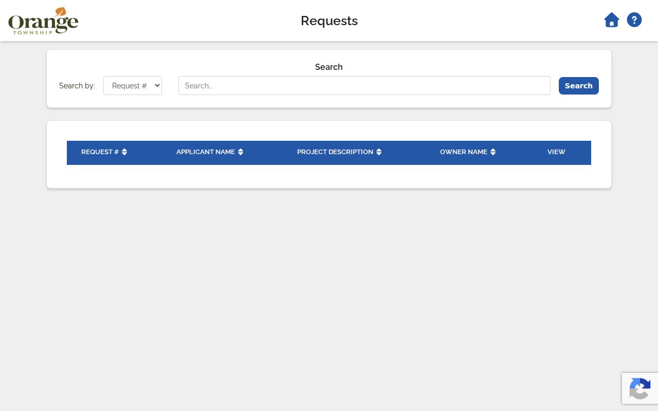
A permit result belongs in an Orange Township address timeline alongside the parcel and deed data, with the project date kept separate from any claim about occupants.
Orange Township’s zoning forms and application channel provides the online submission route and status updates. For a record not shown online, direct a narrow request to the Township custodian or the responsible county department.
Note: The Orange Township zoning code took effect in March 2026, so an older permit should be read under the code and file conditions applicable at its date.
Orange Township Street Records Compared
Different Orange Township address records answer different questions. Pairing them is more reliable than asking one record to do everything. The table separates online access from in-person and request channels, which matter whenever a result is incomplete or a historic document is not scanned.
| Address record | What it can show | How to reach it |
|---|---|---|
| Auditor real-estate card | Parcel, owner, situs, legal description, values, and transfer details. | Property portal, Auditor counter, or phone. |
| GIS selected parcel | Mapped parcel, nearby geography, layers, plats, surveys, and Auditor link. | Public viewer, GIS office, and Help Guide. |
| Recorder tract index | Grantor, grantee, instrument, book or page, and legal-description chain. | Web index for its stated modern coverage, then Recorder exam room. |
| Treasurer tax lookup | Parcel, owner-last-name, or address tax-search path. | Online lookup or Treasurer counter. |
| Township zoning file | Project, permit, compliance, or hearing trail. | Online application path or address-specific request. |
| Building Safety file | County building, floodplain, or zoning administration material. | Department contact or custodian request. |
The county public-records process routes a request to the office that keeps the record. One elected office cannot supply another office’s records. A precise address, date range, and record type give a custodian a usable request without asking for a speculative resident list.
Orange Township Street Plats and Taxes
A subdivision street can be read through its parcel, recorded plat, survey link, and tax trail. Lot, block, subdivision, and legal-description details are especially valuable where a modern street number did not exist when an older deed was recorded. The GIS layer path can open a scanned plat or survey PDF when it is available. If a plat is not available in the popup, use the Recorder’s tract and legal-description route instead of guessing from a map line.
The Delaware County Treasurer property-tax lookup accepts a parcel number with or without hyphens, an owner last name, or a street-number and street-name search.
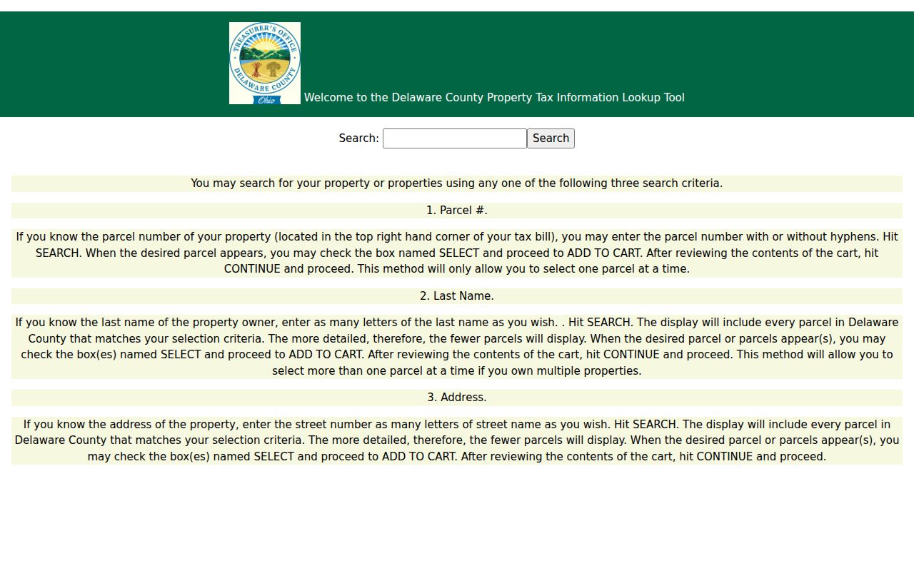
The Treasurer path offers another way to confirm an Orange Township parcel before comparing it with the Auditor record and recorded documents. It is still a property and tax trail, not an occupant directory.
Orange Township Street Directory Shelves
Historic addresses need date-stamped sources. The Delaware County District Library Local History Room keeps historical Delaware City and Delaware County directories, census microfilm and indices, newspapers, cemetery resources, and related local material for in-library use. Cryder Research Library adds rural-route directories, maps and atlases, obituary files, property-transfer material, and yearbooks. Neither institution’s published information proves an exact online year run for a particular Orange Township criss-cross directory, so ask staff to check the relevant shelf or appointment collection.
The Historical Society’s digital collection contains eleven Delaware and Delaware County city directories from 1859 through 1922. Baker’s 1905-1906 volume includes a Delaware County private-resident section, but the collection is not an unbroken annual Orange Township series. Those sources can support a historical household clue only for the edition and address actually consulted.
For a deeper historical directory search, use the Orange Township Directory Book, where the collection and its date limits are the central record trail.
Orange Township Map Dates Matter
The county’s GIS transition is a timely reason to record the date of every Orange Township map check. In June 2026, Delaware County said the Auditor GIS website would be replaced while both systems were maintained. The county also cautioned that new-site parcel geometry would temporarily omit changes made since September while updates occurred. Check the current map date and preserve the underlying deed, survey, or plat when a boundary change matters.
Historic aerial imagery in Auditor GIS reaches from 1997 forward. It can help compare physical development with a conveyance or permit date, but an aerial image cannot establish title, an exact boundary, or who was present at a property.
Orange Township Street Voter Checks
Ohio’s official voter tools are individual confirmation tools, not a browse-by-street directory. The current statewide lookup uses first name, last name, and county, and Delaware’s county form similarly expects a named individual. After the property and deed evidence points to a specific person, an official result can be treated as one dated confirmation point only. An absent match does not prove that a person does not live in Orange Township.
The underlying statewide database has residence and precinct fields, but public rules also protect sensitive identifiers and confidential records. If a releasable voter-file dataset is needed for a lawful records question, ask the Delaware County Board of Elections about its current conditions, fields, fees, and redactions. Never use public snapshots or postal data to reconstruct a street roster.
Privacy Limits for Orange Township Streets
An Orange Township street directory can document parcels, recorded owners, dated conveyances, permits, and historical directory entries. It cannot reliably show every renter, adult household member, utility customer, delivery recipient, or driver-record address. Motor-vehicle personal information is not an address-search substitute. Nor is a protected address a gap to work around. Safe at Home participants and qualifying public-safety personnel can have address information protected or redacted from ordinary public voter records.
The Ohio Safe at Home program and the state’s address-redaction protections are deliberate confidentiality measures. When a public record is withheld or redacted, ask the custodian for the legal basis and for separable material if appropriate under the Ohio Public Records Act. Do not use nearby parcels, older directories, or another source to try to reconstruct protected information.
Lawful use. Orange Township address records support personal research, property history, and family history. Do not use them to stalk, harass, intimidate, or defeat a confidential-address program.
When the question becomes whether a named person is connected to a record, use the Orange Township Resident Lookup for a one-person, source-by-source verification path rather than expanding a street result into a claim about a household.
Note: Preserve the original custodian link, record date, and parcel or instrument reference before relying on any Orange Township street finding.