
Orange Township ZIP Code Coverage
For Orange Township, County GIS supports four confirmed ZIP-polygon intersections. The Orange Township ZIP code directory does not claim that an entire ZIP lies in Orange Township. It identifies the postal labels and intersections that deserve an address-by-address check. A wide address-point query also surfaced several additional labels, but those were not confirmed as townshipwide coverage and should not be used as a shortcut. USPS answers delivery ZIP questions. County GIS answers where a parcel sits in relation to township and municipal lines.
| ZIP | Areas Covered | Post Office | Notes |
|---|---|---|---|
| 43035 | Lewis Center; official township material uses this postal label | Lewis Center Post Office | Primary Orange Township mailing label, but its ZIP boundary is not Orange Township boundary. |
| 43082 | Westerville postal label in nearby and Orange-area county material | Verify the individual address with USPS and GIS | Southern and eastern overlap needs a parcel and Township-layer check. |
| 43235 | Columbus postal label | Verify the individual address with USPS and GIS | County GIS identifies a ZIP-boundary intersection with Orange Township. |
| 43240 | Columbus postal label | Verify the individual address with USPS and GIS | County GIS identifies a ZIP-boundary intersection; annexation and postal boundaries differ. |
Orange Township researchers should not treat 43015, 43021, or 43065 as proven townshipwide coverage. A broad county address-point query returned those labels, while the cleaner polygon intersection did not. That mismatch may reflect delivery geometry or data placement, so the only sound next step is a USPS check for the street address and a GIS check for the parcel.
Note: Confirm USPS delivery with a full address before treating a ZIP label as a useful Orange Township parcel filter.
Orange Township ZIP Anchor
Orange Township’s strongest local postal anchor is Lewis Center 43035. Orange Township Hall uses the Lewis Center mailing label, and USPS identifies the Lewis Center Post Office at 393 E. Orange Road, Lewis Center, OH 43035-9998. That makes the label useful for checking a delivery address, but it does not convert every nearby parcel into township land or establish an owner’s residence.
USPS lists the Lewis Center Post Office as the local postal reference for this connection.
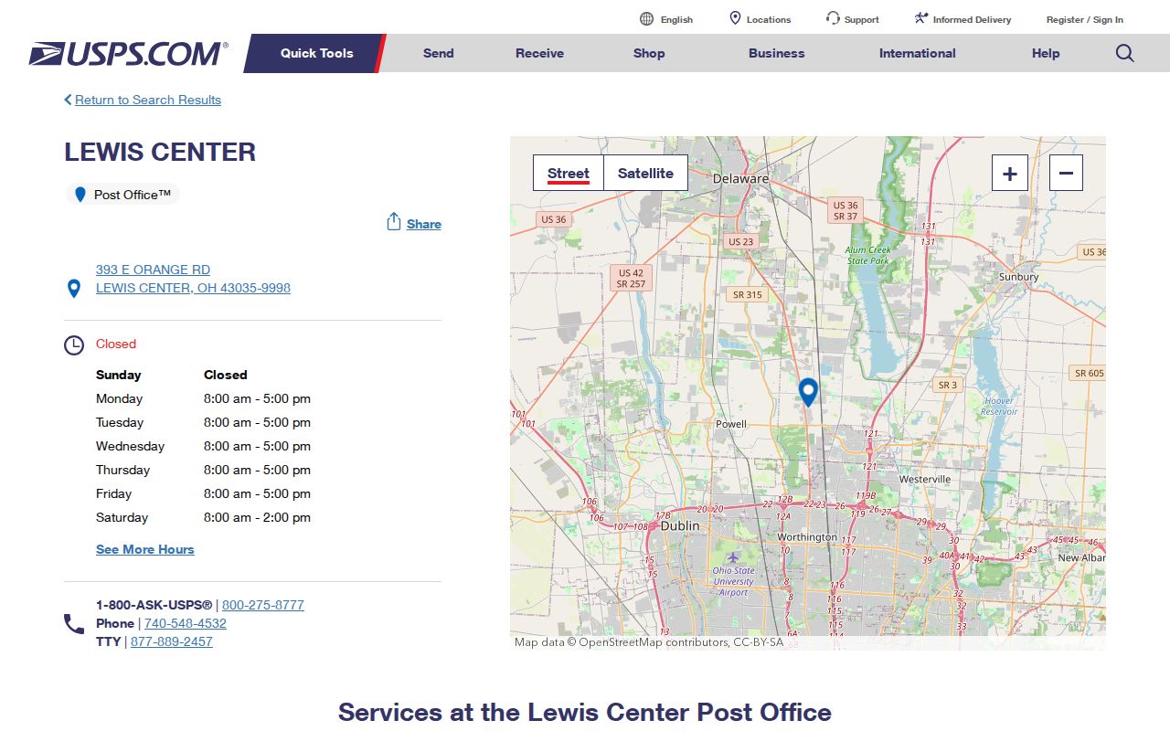
The USPS listing supports the Lewis Center and 43035 link. For a specific property, use the USPS ZIP Code Lookup with the full address rather than relying on a post-office label or a map pin.
Search Orange Township by ZIP
An Orange Township ZIP result is a starting filter for parcel research, not a population list. Delaware County Auditor GIS permits a ZIP or city in the Property Search Address field. Combine that result with the Township filter when appropriate, inspect the selected parcels, and then verify the exact delivery ZIP through USPS. The process narrows a large county result set without confusing postal geography with civic jurisdiction.
- Enter the ZIP or postal city in the Auditor GIS Address field and review the matching property results.
- Add Township = Orange in Advanced Search when the result set reaches across labels or municipal areas.
- Select each parcel and inspect its address, legal description, subdivision, and township or municipality context.
- Turn on ZIP, Township, Municipality, Annexation, Address Point, Street Centerline, and Parcel layers when a boundary question remains.
- Run the full street address through the USPS lookup to confirm the current delivery answer.
- Use the parcel, owner, and legal-description result only as the next research lead, not as proof of every person at that address.
Once a ZIP filter has narrowed the right road or parcel, the Orange Township street directory gives the address-to-parcel and recorded-document sequence. The public voter lookup is an individual verification tool, not a ZIP-wide or street-wide browser.
Orange Township ZIP Fields
The Delaware County Auditor GIS Help Guide documents the fields that make a ZIP search more precise. One Property Search criterion is required. The Address route accepts a city or ZIP, while advanced fields reduce a countywide result to the appropriate township, street, subdivision, municipality, or time period. The map’s public query service has a 1,000-record maximum, so a broad postal search may need a second filter before it can be reviewed reliably.
| Portal control | Field type | ZIP function or limit |
|---|---|---|
| Property Search, Address | Smart-autocomplete text | Accepts a city or ZIP as the one property-search criterion. |
| Advanced Search, Township | Selectable criterion | Choose Orange to reduce postal-label spillover. |
| Street Name, Subdivision, Municipality | Smart text or selection | Further narrows a postal result to a location or development. |
| ZIP layer | Polygon layer with ZIP_CODE and NAME | Shows reference ZIP geography; it is not USPS’s delivery determination. |
| USPS lookup | Address, city, and state input | Checks a specific delivery address one at a time. |
The selected GIS parcel can link onward to Auditor detail. Preserve the parcel number as returned. The county does not publish a universal one-line parcel-number format that should be guessed or rebuilt from a map label.
Note: A broad GIS result can require extra filters because the county’s published query service has a 1,000-record maximum.
Orange Township ZIP Boundaries
For Orange Township, ZIP boundaries, township boundaries, municipal boundaries, and annexation are separate maps in Delaware County. A Lewis Center, Powell, Westerville, Delaware, or Columbus label answers a postal question. It does not determine whether Orange Township zoning, a municipal office, or a county department holds a record. The county data service provides distinct layers for ZIP, Township, Municipality, Annexation, Address Point, Parcel, and Street Centerline precisely because those answers can differ.
Boundary check. Use USPS to verify mail delivery, then use the county parcel and boundary layers to identify the actual Orange Township or municipal recordkeeper.
Orange Township’s zoning map is a second official visual reference for township boundary, roads, zoning districts, incorporated areas, parks, schools, and landmarks. It can help route an Orange Township address-specific permit or zoning question, but it does not replace the parcel record or the USPS address result.
Orange Township ZIP Labels
Postal labels are especially easy to overread in this township. The local geography includes Lewis Center, Powell, Westerville, Delaware, and Columbus labels, while the county seat and many records offices are in the City of Delaware. Resolve the parcel first, then use the Township, Municipality, and Annexation layers before sending a zoning or records request. That method avoids asking Orange Township for a file that belongs with another municipality or county custodian.
Orange Township’s Community Links page is an official municipal referral point for the area.
The community page helps identify public referral channels, not a neighborhood member directory and not a final answer to a ZIP boundary question. The parcel and the exact USPS delivery result remain the correct checks.
Parcel Terms for ZIP Searches
Orange Township postal research becomes more reliable when the property terms are kept separate. An Auditor record can contain a street-facing location, an owner mailing address, a legal description, and a county parcel number. They are not interchangeable. In particular, a mailing address can be outside Orange Township even when the situs parcel is inside it, while the legal description is the durable link to a deed or plat if a street number or postal label changes.
- ZIP and ZIP+4
- A ZIP code identifies a broader delivery area. The added four digits refine routing for a specific address or delivery segment; use USPS for the current exact value.
- PO-box ZIP
- A ZIP used for post-office box delivery. Do not assume it describes the physical location of a parcel.
- Unique ZIP
- A ZIP assigned for a single organization or specialized delivery purpose. None should be presumed in Orange Township without USPS confirmation.
- Carrier route
- A postal delivery grouping used to organize mail. It is not a township, municipal, or property-record boundary.
Note: Store the postal result and parcel identifier separately so later deed or zoning research retains the correct geography.
Historic Orange Township ZIP Clues
Do not retrofit a modern ZIP onto an old directory, rural route, deed, or newspaper notice. Start historical work with the address as printed, the parcel or legal description, maps or atlases, and the recorded land trail. The county’s Local History and Genealogy collection and the Cryder Research Library provide directories, maps, newspapers, rural-route clues, and property-transfer material that can establish a dated place.
No official source in the research established a dated Orange Township ZIP split, realignment, or ZIP population count. The absence of that evidence matters. Use the historical source as it stands, then run a modern USPS lookup only when a current mailing ZIP is actually needed.
Note: A historic address and a current delivery ZIP answer different questions and should be recorded with their separate source dates.
Orange Township ZIP to Street
After an Orange Township ZIP filter identifies a likely parcel, shift from postal geography to land records. The Auditor parcel card can provide the recorded owner, situs address, legal description, market and transfer context. A Recorder search then follows the owner, grantee or grantor, instrument number, book and page, and legal description. The Recorder’s public real-estate web coverage begins in 1990, with earlier records and exceptions at the Recorder’s office.
This handoff keeps the ZIP code directory focused on its own purpose. ZIP results identify a geographic starting point. Parcel, deed, and dated record evidence do the work of confirming a property trail. The tax-roll owner still does not establish every occupant at that location.
ZIP Limits in Orange Township
County GIS is in a published replacement transition, with both systems maintained while the new site’s parcel geometry is updated. The county says the new geometry can temporarily lack some changes made since September during the update process. Check the map’s current information before relying on a recent parcel change, and confirm a consequential record with the responsible custodian.
A ZIP code directory can make the next search narrower, but it cannot establish a household, settle a survey line, or choose a recordkeeper without the parcel and boundary checks. Keep the delivery result, the GIS result, and the underlying record in their proper roles.